As winter storm moves across US, ice becomes bigger concern
Multiday storm dumped more than a foot of snow in parts of the Midwest and triggered warnings from Texas to Maine.

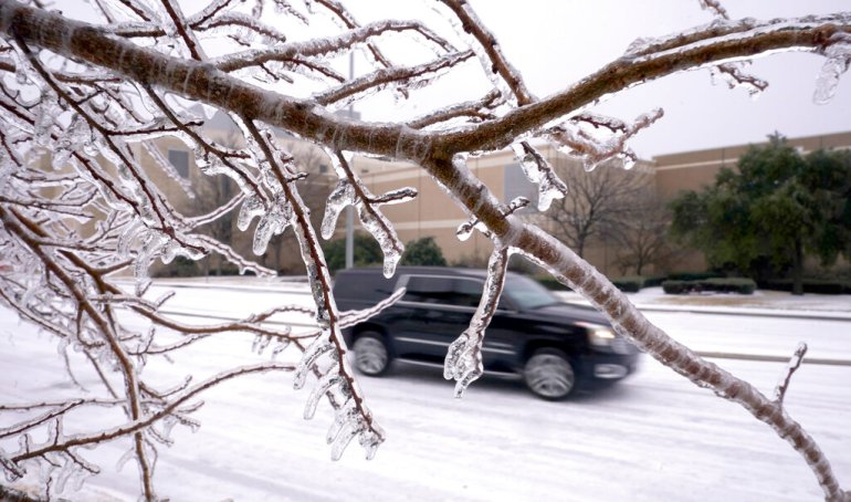
More than 200,000 homes and businesses lost power across the United States on Thursday as power companies struggled to keep pace with freezing rain and snow that weighed down tree limbs and encrusted power lines after a winter storm spread from Texas to the Northeast.
Power outages blamed on icy or downed power lines were concentrated in Tennessee, Arkansas and Texas, but the path of the storm stretched further from the central US into the South and Northeast.
Keep reading
list of 4 itemsIn Pictures: Trapped by snow in remote Moroccan mountain village
At least 21 dead as heavy snow traps people in cars in Pakistan
In Pictures: Snow blankets Athens, Greek islands and Istanbul
Heavy snow was expected from the southern Rockies to northern New England, while forecasters said heavy ice buildup was likely from Texas to Pennsylvania.
“We have a lot of real estate covered by winter weather impacts this morning,” Andrew Orrison, a meteorologist with the National Weather Service in College Park, Maryland, said early on Thursday. “We do have an expansive area of heavy snow, sleet and freezing rain occurring.”
Parts of Ohio, New York and northern New England were expected to see heavy snowfall as the storm moves to the east with 30 to 45 centimetres (12 to 18 inches) of snow possible in some places through Friday, Orrison said.
Along the warmer side of the storm, strong thunderstorms capable of damaging wind gusts and tornadoes were possible on Thursday in parts of Mississippi and Alabama, the Storm Prediction Center said.

The Midwestern snowstorm is nothing too unusual except in some places, it was so large that it had a bigger than normal path of intense snow, said Northern Illinois University meteorology professor Victor Gensini. With a warmer climate, people are forgetting what a Midwestern winter had long been like, he said.
“The only amazing winters I’ve been able to experience is through my parents’ photographs of the 1970s,” said Gensini, who is 35. “This [storm] is par for the course, not only for the past, but winters current.”
More than 51 centimetres (20 inches) of snow was reported in the southern Rockies, while more than a foot of snow fell in areas of Illinois, Indiana and Michigan.
Sleet and freezing rain were occurring early on Thursday in the Dallas-Fort Worth area and parts of Oklahoma and Arkansas. More than 200,000 homes and businesses were without power, mostly in Texas, Tennessee and Arkansas, according to the website poweroutage.us, which tracks utility reports.
“Unfortunately we are looking at enough ice accumulations that we will be looking at significant travel impacts,” Orrison said.
DALLAS – View from I-35 @ Colorado Blvd. around 7:30a & you can see the ongoing wintry mix near downtown. Crews applying materials & plowing as storm continues. Not too much traffic on this view which is good! Avoid travel if possible during this #winterstorm. #txwx pic.twitter.com/oBDI2jTJ8U
— TxDOT Dallas (@TxDOTDallas) February 3, 2022
Tennessee had the highest number of reported power outages by midday, particularly in Memphis and surrounding areas in West Tennessee.
Trees sagged under the weight of ice in Memphis, resulting in fallen tree limbs and branches. Parked cars had a layer of ice on them and authorities in several communities around the city warned of some cars sliding off slick roadways.
In Texas, the return of subfreezing weather brought heightened anxiety nearly a year after February 2021’s catastrophic freeze that buckled the state’s power grid for days, leading to hundreds of deaths in one of the worst blackouts in US history.
Facing a new test of Texas’ grid, Republican Governor Greg Abbott said it was holding up and on track to have more than enough power to get through the storm. Texas had about 70,000 outages by Thursday morning, but Abbott and local officials said that was due to high winds or icy and downed transmission lines, not grid failures.
South Bend, Indiana, reported a record snowfall for the date on Wednesday with 28.5 centimetres (11.2 inches), eclipsing the previous record of 20.3 centimetres (8 inches) set on the date in 1908, said Hannah Carpenter, a meteorologist with the National Weather Service’s office in Syracuse, Indiana.
Once the storm pushes through, she said temperatures will see a big drop. “It’s definitely not going to be melting real quick here,” Carpenter said on Thursday morning.

The frigid temperatures settled into areas after the snowy weather, with Kansas residents awakening to dangerous wind chills of about -26 degrees Celsius (-15 Fahrenheit).
In New Mexico, schools and non-essential government services were closed in some areas Thursday because of the icy roads.
The disruptive storm began on Tuesday and moved across the central US on Wednesday’s Groundhog Day, the same day the famed groundhog Punxsutawney Phil predicted six more weeks of winter.
The storm came on the heels of a Nor’easter last weekend that brought blizzard conditions to many parts of the East Coast.
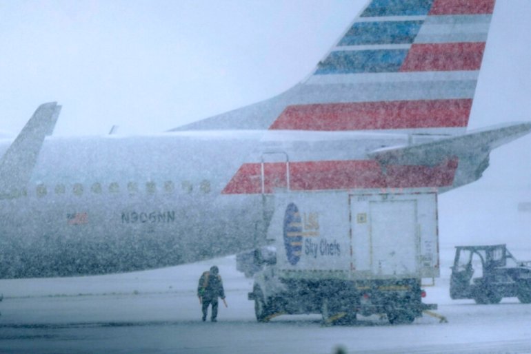
Airlines cancelled nearly 7,000 flights in the US scheduled for Wednesday or Thursday, the flight-tracking service FlightAware.com showed. More than a thousand flights were cancelled Thursday alone at Dallas-Fort Worth International Airport, and more than 300 were cancelled at nearby Dallas Love Field.