Concerns rise as El Nino approaches
The natural phenomenon known to bring turmoil to global weather patterns is back.
Published On 29 Jul 2009
 |
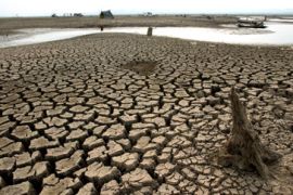
| El Niño often leads to drought in Australia and parts of Southeast Asia [GALLO/GETTY] |
The waters of the Pacific are moving and in Australia farmers are getting nervous.
El Niño, the natural phenomenon known to bring turmoil to global weather patterns, is back.
Keep reading
list of 4 itemsTurtles swimming to extinction in Malaysia as male hatchlings feel heat
Could shipping containers be the answer to Ghana’s housing crisis?
Thousands protest against over-tourism in Spain’s Canary Islands
Over the last couple of months the waters of the Pacific have shifted and the first impacts are already being seen.
During a ‘normal’ year, the prevailing winds push the warm surface waters of the Pacific toward Indonesia. This makes the waters there about 8°C warmer and half a metre higher than the waters along the west coast of South America.
During El Niño, the winds ease and this allows warmer waters to well up along the west coast of South America, around Peru and Ecuador.
The change is tiny, just a couple of degrees Celsius, but it has a dramatic affect.
Livelihoods destroyed
The fish that prefer colder waters are no longer found off the coast of Peru or Ecuador, but instead swim thousands of miles further north or south.
This can devastate the livelihood of the fishermen and severely damage economies: The demise of the Peruvian anchovy industry is largely blamed on the El Niño event of the early 1970s.
The warmer waters can also well up near the coast of California, disrupting existing marine life there.
During El Niño, an increase in the number of malnourished sea lions has been noticed, as their favourite foods such as squid, anchovies, herring and sardines, disappear in search of colder waters.
This year the Marine Mammal Centre in Sausalito, California, has already noticed an increase in the number of sea lions it has rescued.
In the past, the effects of El Niño have been observed on marine life as far away as Antarctica, but it is not just the sea life that suffers.
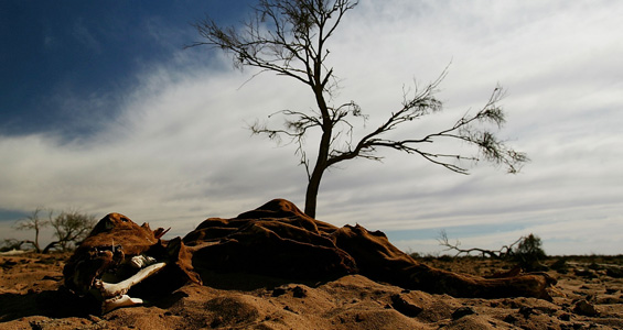
Drought
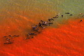 |
| Fishermen’s livelihoods can be devastated as fish swim further away [GALLO/GETTY] |
The warmer waters of the Pacific generate showers, which usually fall across Indonesia.
As the waters head east, so do the showers. Indonesia sees drier weather and the rains over the coast of Peru or Bolivia become heavier. Over the last month or so there has been a decrease in the rainfall over Indonesia.
The effects are expected to become even more widespread in the coming period between December and February.
The dry conditions over Indonesia are forecast to spread, with much of southeast Asia and northern Australia drying out. The last thing Australia needs is another drought.
Certain other places, however, can expect things to get a lot wetter.
California is one of the places that often sees flooding during El Niño events. Northern Argentina, Uruguay, Southern Brazil and Paraguay are in the firing line too, and Uganda, Kenya, southern Sudan and southern Ethiopia are also likely candidates.
But it is not all a disaster – El Niño events usually bring milder winters to Japan and Canada, and they reduce the risk of hurricanes. This global weather phenomenon also indirectly disrupts the vertical development of storms in the Atlantic which should mean a quiet hurricane season.
Unpredictable
An El Niño is a completely natural event that usually lasts between a year and 18 months. It rears its head every two to seven years, with varying degrees of vigour.
We know that they have been occurring for thousands of years, but their global affects were not recognised until the 1900s.
To this day, they are still not fully understood.
Obviously this means that forecasting their affect is going to be nigh on impossible. Even forecasting the actual El Niño itself is not easy; it is difficult to say when an El Niño event is going to occur and equally difficult to say how strong an event is going to be.
As if to prove the point, current forecasts cannot agree on the strength of this latest El Niño event.
Mike Halpert, the deputy director of the Climate Prediction Centre at The National Oceanic and Atmospheric Administration (NOAA), says: “The most recent dynamical (model) forecasts have come in a bit stronger, with the large majority of them forecasting a moderate to even strong event.
“Right now, it is hard to imagine this event rivalling the very strong events of 1982/83 and 1997/98.”
The stronger the event, the larger the change in temperature across the Pacific, and the larger the bearing it has on the weather across the globe. However, none of these droughts or floods can ever be guaranteed.
We may see all of these disasters, but then again we may see none.
Steff Gaulter is Al Jazeera’s senior weather presenter.
Source: Al Jazeera