Satellite images show scale of destruction in Turkey-Syria quake
Haunting satellite images are starting to come through, showing the level of destruction left behind in Turkey by the series of earthquakes that devastated the region near its border with Syria.
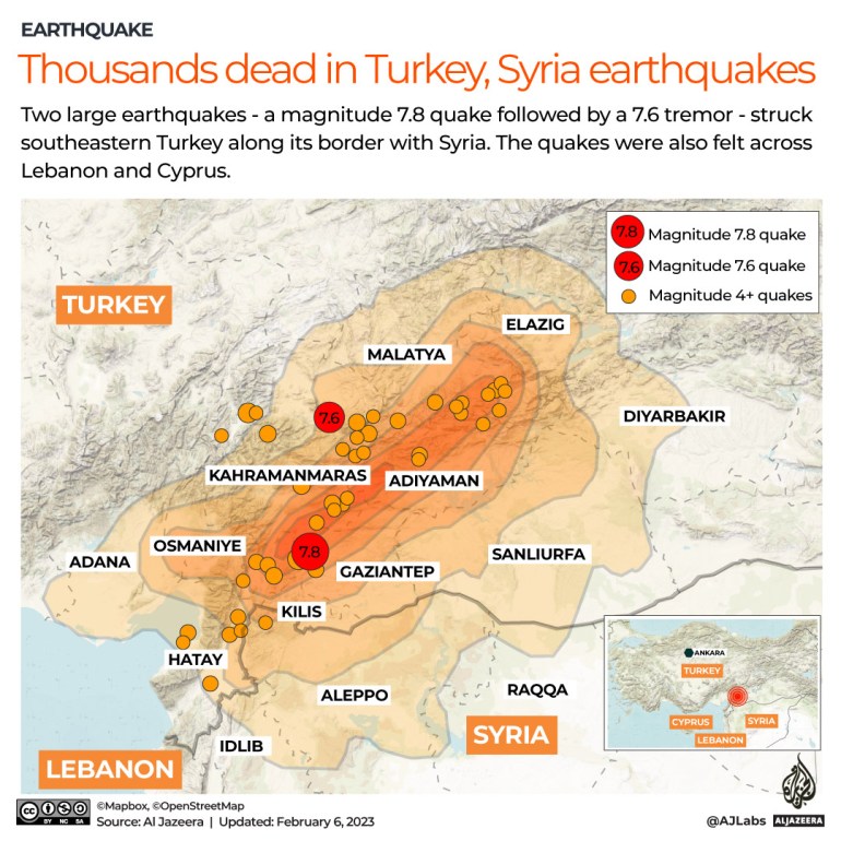
The first earthquake, magnitude 7.8, struck at 4:17am (01:17 GMT) on Monday and was centred in the Pazarcik district of Kahramanmaras province. It was followed by dozens of aftershocks.
Less than 12 hours later, a second, magnitude 7.6, earthquake struck the same region.

Drag to the right to see buildings in Islahiye, Turkey, before the earthquake, and to the left to see the after-effects [Handout: Maxar Technology via Reuters]
Drag to the right to see buildings in Islahiye, Turkey, before the earthquake, and to the left to see the after-effects [Handout: Maxar Technology via Reuters]
Buildings in Nurdagi, Turkey, before and after the earthquake [Handout: Maxar Technology via Reuters]
Downtown Islahiye before (drag right) and after the earthquake [Handout: Maxar Technology via Reuters]
Buildings in Nurdagi before and after the earthquake [Handout: Maxar Technology via Reuters]
Downtown Nurdagi before and after the earthquake [Handout: Maxar Technology via Reuters]