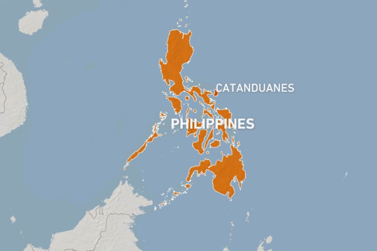
Tsunami warning after earthquake struck off eastern Philippines
State agency says it caused a ‘minor sea-level disturbance’ and warned waves of less than a metre higher than normal.

A tsunami warning has been triggered and evacuation order issued to coastal dwellers on a remote Philippine island after a strong earthquake struck in the ocean off the archipelago.
The United States Geological Survey said that 6.2-magnitude earthquake struck in the ocean off the coast of the eastern Philippines on Tuesday around 9pm (13:00 GMT) about 120km (75 miles) from Catanduanes Island, off the main island of Luzon.
Keep reading
list of 4 itemsPhotos: Life in a cemetery after Turkey’s earthquakes
Afraa, Syria’s ‘earthquake miracle’ baby, turns 40 days old
Floods in Turkey kill 13 people in earthquake-affected provinces
The European Mediterranean Seismological Centre (EMSC) said that it initially estimated the quake was a magnitude 6.3 one while the Philippine Institute of Volcanology and Seismology reported it at magnitude 6.6.
Shallow quakes tend to cause more damage than deeper ones, but so far there have been no immediate reports of damage on Catanduanes.
The state seismological agency said that the quake had caused a “minor sea-level disturbance” and warned that tsunami waves of less than a metre high above normal tides would reach Catanduanes and Samar islands.
“These waves may continue for hours,” it said.
ADVISORY: MINOR SEA-LEVEL DISTURBANCE
Tsunami Information No.1
Date and Time: 04 Apr 2023 – 08:54 PM
Magnitude = 6.6
Depth = 09 kilometers
Location = 13.76°N, 125.51°E – Offshore Gigmoto (Catanduanes)https://t.co/XBgoky2qxJ pic.twitter.com/twCGN2v18e— PHIVOLCS-DOST (@phivolcs_dost) April 4, 2023
Local disaster officers have been instructed to “ask those living near the sea to evacuate first to higher ground,” said Luis Surtida, Catanduanes provincial disaster officer.
Authorities on Samar said there had been no evacuation order for the island.
So far, there were no reports of significant damage to buildings or infrastructure on Catanduanes, a poor farming island frequently hit by typhoons.
“It wasn’t that strong to generate damage,” said Prince Obo, a disaster officer in Catanduanes’s Gigmoto municipality.
Police Corporal Rodin Balcueva said the quake was “quite strong” in Pandan municipality, on the northern tip of Catanduanes.
Quakes are a regular occurrence in the Philippines, which sits along the Pacific “Ring of Fire”, an arc of intense seismic and volcanic activity that stretches from Japan through Southeast Asia and across the Pacific basin.
Most of the earthquakes are too weak to be felt by humans, but strong and destructive ones come at random with no technology available to predict when and where they will happen.
The last major quake was in the northern Philippines in October.
The magnitude 6.4 earthquake hit the mountain town of Dolores in Abra province, injuring several people, damaging buildings and cutting power to most of the region.
A magnitude 7 quake in mountainous Abra last July triggered landslides and ground fissures, killing 11 people.