Winter storm sweeps across the Levant and Arabia
The weather system has brought snow in places and widespread poor visibility.
Published On 26 Feb 2020
A large area of low pressure, the second in the space of a week, has swept into the Levant bringing wet, windy and, in some places, snowy weather.
The centre of the “low” was over eastern Iraq early on Wednesday but the worst of the weather was extending further east into central-northern Iran.
Keep reading
list of 4 itemsAre seed-sowing drones the answer to global deforestation?
Rainfall set to help crews battling wildfire near Canada’s Fort McMurray
How India is racing against time to save the endangered red panda
At 07:00 GMT, Payam International Airport, just 35km (22 miles) northwest of the capital, Tehran, reported a temperature of -1 degree Celsius (30 degrees Fahrenheit) with a sustained wind of 39kmph (24mph). This makes for a wind chill – a measure of how cold it feels – of -9C (16F).
There was also heavy snow in Payam that reduced visibility to just 300 metres (984 feet).
Tehran, lying at an elevation some 200 metres (656 feet) lower than Payam, recorded a temperature of just 4C (39F) with rain, rather than snow.
Although the cold, wet weather extended into eastern Iraq, Baghdad was much better with a temperature of 14C (57F). Nevertheless, the wind was sufficient to generate dust, reducing visibility to 1,400 metres (4,593 feet).
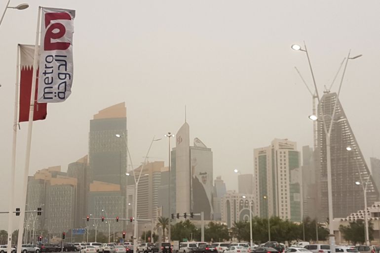
The cold front associated with the low extended down through the northern Gulf and much of northern and central Saudi Arabia and Qatar.
A visibility report of 4,000 metres (13,123 feet) from the US military base at Al Udeid, just to the west of Doha, Qatar, was typical of much of the region as a result of shamal winds blowing at between 40-50kmph (25-31mph).
The dust is expected to sweep southeastwards across the rest of Saudi Arabia and the United Arab Emirates in the next few hours, and then there will be a gradual decrease in winds before the weekend.
By that time, visibility and temperatures will return to the seasonal average.
Source: Al Jazeera