Oz’s hot and wet continental divide
A cyclone revolves off the Queensland coast while Western Australia harbours record heat.
Published On 5 Apr 2018
Tropical cyclone Iris has been around for what seems like ages.
Indeed she wandered up the Great Barrier Reef last week, went around Willis Island, and came back down, closer to the Australian coast.
Keep reading
list of 4 itemsBrazil’s army is rescuing people stranded by deadly flooding
Photos: Death toll rises to 78 amid Brazilian storms and floods
At least 75 killed, more than 100 others missing in Brazil floods
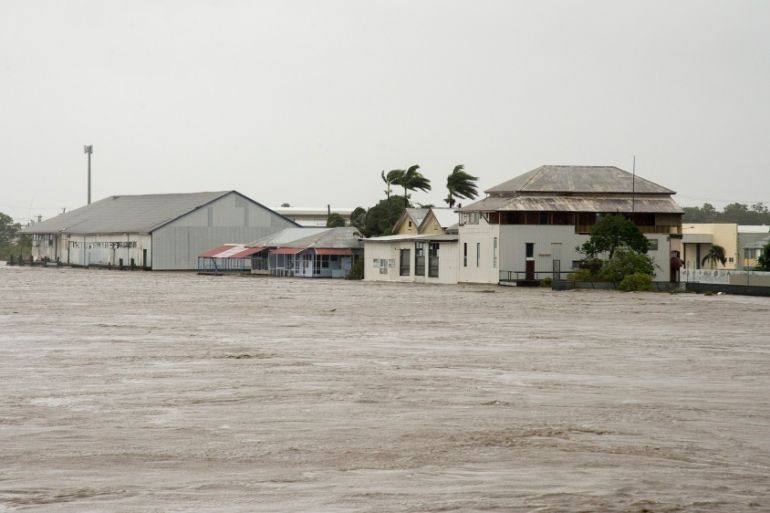
Iris has come close enough to Queensland to cause dangerous weather in areas of the Central Coast and Whitsundays.
These areas were pounded by Severe Tropical Cyclone Debbie just over one year ago: Iris has been far less intense but is still producing large waves along Queensland’s central coast although the Great Barrier Reef is preventing some of the ocean’s energy from reaching the coast.
On Wednesday morning, wave heights were measured at up to 2.5 metres near the coast, but up to four metres around 35km off the coast of Mackay. Mackay has recorded 150m of rain in three days which has caused some flooding.
Hamilton Island experienced wind gusts of 106km per hour and all major ports and marinas in the Whitsundays and Mackay were closed on Wednesday, with ferry services to Whitsunday Islands suspended.
While a cyclone rotated off the Queensland coast, on the opposite side of the continent, it has been unreasonably and unseasonably hot. Western Australia‘s Pilbara District was in the middle 40s degrees Celsius a week ago and is still far hotter than is normal.
Roebourne and Mardie registered highs of 45.9C last Wednesday and Thursday, respectively. These were both the highest temperatures on record in Australia this late in the season.
Yesterday, Port Hedland’s reported 43.6C made the hottest April day since 1948, while 42.6C at Learmonth was its hottest April day in 43 years.
This unseasonably hot air mass over the Pilbara is on the move. Northerly winds developing ahead of a broad low-pressure trough will transport the heat down to the continent’s southern states in the coming days.
This impending bout of heat in South Australia, New South Wales and Australia Capital Territory will be prolonged and potentially record-breaking for this late in the season.
Additional info from weatherzone.com.au
Source: Al Jazeera, News Agencies