Map: Exclusive aerial images of Syria
Click on neighbourhoods in Homs and Idlib for close-ups of army deployments and widespread destruction.
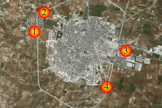
HOMS
If you are having trouble viewing the map above, please upgrade your internet browser.
|
Satellite images: Homs The imagery, commissioned by Al Jazeera, provides snapshots of the Syrian city’s dire situation. Government forces’ continued shelling of the Syrian city has left some neighbourhoods unrecognisable. Satellite images taken this March reveal a deserted city centre, destroyed areas and heavy deployment of tanks across the city. This stands in contrast to images shot in August, which showed a busy city of around one million. The latest imagery provides a snapshot of what appears to be an increasingly dire situation, as Steve Chao reports. |
IDLIB
|
Satellite images: Idlib
The city of Idlib has been a key hub of opposition activity throughout the uprising in Syria. In March, just before a ceasefire was agreed to, the government launched a massive offensive. Al Jazeera has obtained satellite images that show how the army choked off the city. Steve Chao reports on the government’s strategy to isolate the people of Idlib. |