First Atlantic hurricane expected
Caribbean islands prepare as Tropical Storm Irene intensifies
Published On 21 Aug 2011
 |
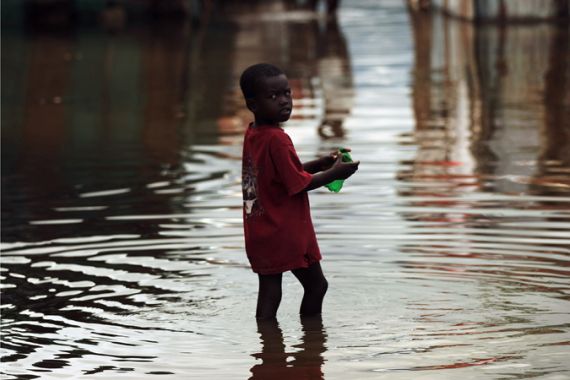
| Hundreds of thousands of people still live in Haitian tent communities and are especially vulnerable to storms [Getty] |
When it comes to tropical development in the Caribbean, the worst case scenario could be brewing.
A tropical storm that is expected to strengthen into a hurricane has its track set towards the vulnerable island of Hispaniola.
Keep reading
list of 4 itemsTurtles swimming to extinction in Malaysia as male hatchlings feel heat
Could shipping containers be the answer to Ghana’s housing crisis?
Thousands protest against over-tourism in Spain’s Canary Islands
Tropical Storm Irene originated just under 100 kilometers to the east of the island of Guadeloupe in the Lesser Antilles. As Irene approached the island, the winds increased and tropical storm warnings are now in effect for Guadeloupe and the surrounding islands.
In the next 24 hours the storm is expected to continue to track to the west before beginning a gradual turn to the northwest. This will bring Irene’s path very close to the southern coast of Puerto Rico early Monday morning.
Irene could become the first hurricane of the 2011 Atlantic hurricane season by Monday afternoon. As of now, most of the forecast models are in fairly good agreement that Irene will make a landfall on the southern coast of the Dominican Republic sometime from late Monday evening into early Tuesday. At this point we could be looking at sustained winds of 137 kilometres per hour, a category one hurricane.
Starting on Monday evening, the southern regions of the Dominican Republic are expected to see exceptional amounts of rainfall, possibly totalling well over 400 millimetres. This causes the 3500-metre mountain ranges over Hispaniola to funnel surging water down mountain valleys, leading to deadly flash flooding.
On the deforested Haitian side of the island, rainfall by even the weakest tropical depression could prove fatal as mudslides and landslides are unleashed for this impoverished nation. By Tuesday, a weakened Irene is likely to make its way over Haiti’s capitol of Port-au-Prince.
If the possibility of mudslides and flooding isn’t bad enough for the 600,000 made homeless by the 2010 earthquake, authorities and international organizations fear a possible surge in cholera in the storm’s aftermath. Rising water levels and lack of drinking water put this country at an even higher risk for fatalities.
After passing over Hispaniola, Irene is expected to move back over water briefly before making another landfall on the southern coast of Cuba. Normally the longer a tropical system tracks over land, the weaker it will become. It is a combination of this land and water ratio that will determine the future story for Irene, and if Florida and the Bahamas need to be on alert later in the week.
Source: Al Jazeera