Four tropical storms are raging
Which parts of the world are under threat?
Published On 21 Jul 2011
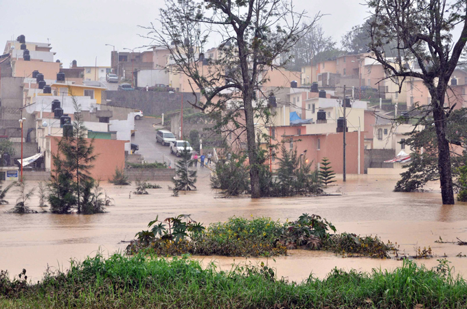 |
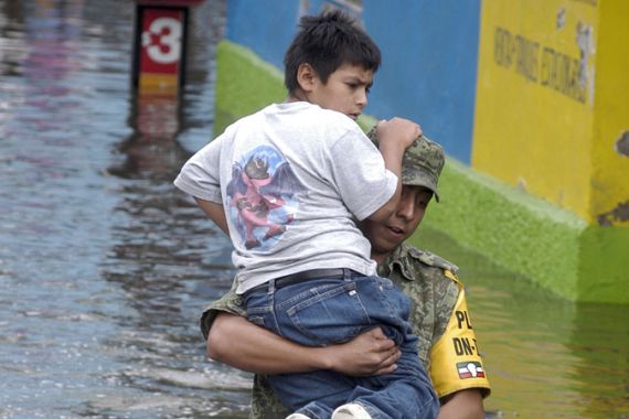
| Tropical Storm Arlene caused widespread flooding when it struck Mexico at the end of June 2011 [EPA] |
In the last few days tropical activity has increased around the globe.
There are now four storms in existence, two in the Atlantic and two in the Pacific.
Keep reading
list of 4 itemsAfter the Hurricane
World’s coral reefs face global bleaching crisis
Why is Germany maintaining economic ties with China?
The two storms in the Atlantic are Tropical Storms Bret and Cindy, the second and third storms of the Atlantic Hurricane Season. The first storm, Arlene, hit eastern Mexico on the last day of June, causing widespread flooding and leading to the deaths of 22 people.
Neither Bret nor Cindy is expected to cause much damage. Initially Bret did form close to the Bahamas, but has since tracked steadily away from land. It’s now harmlessly drifting northeast, halfway between the east coast of the US and Bermuda, weakening as it does so.
Tropical Storm Cindy developed on Wednesday night. This storm too, is in the open waters of the Atlantic, and is not expected to affect land.
There is a far more intense system on the other side of Mexico, called Dora. With sustained winds of over 215kph, Dora is classed as a powerful category four hurricane, on the Saffir Simpson Scale. This is the scale used to rate hurricanes for intensity, the maximum is five.
Hurricane Dora is running parallel to the Mexican coastline, but the eye of the storm isn’t expected to hit land. It’s currently about 350km offshore, which should ensure that the worst of the winds and the heaviest of the rains stay away from land. However, some torrential downpours are still likely along the western coast.
The final storm that’s in existence is in the western Pacific, called Ma-On. In this part of the world, tropical cyclones are called typhoons, and Ma-On was typhoon in strength when it originally made landfall in southern Japan.
Ma-On brought down trees and power lines, and forced road closures and flight cancellations. In the south, on the island of Shikoku, the village of Umaji recorded the most rain from this storm: 850mm rain in just 24-hours. This is over three times the rainfall expected in the whole month, and easily enough to cause severe flooding when it falls in such a short time-period.
As Ma-On moved across land, it began to lose energy and was downgraded to a tropical storm.
The storm now over the Pacific Ocean again, and the eye of the storm should stay away from land. However, the outer bands of the system will continue to bring heavy rain to the southeastern parts of Honshu over the next few days.
Source: Al Jazeera