Dorian offshore; Lingling lands in N Korea; Faxai threatens Japan
Hurricane Dorian now threatens Canada while Typhoon Lingling makes landfall and Faxai won’t be long but threatens Tokyo.
Published On 7 Sep 2019
North America
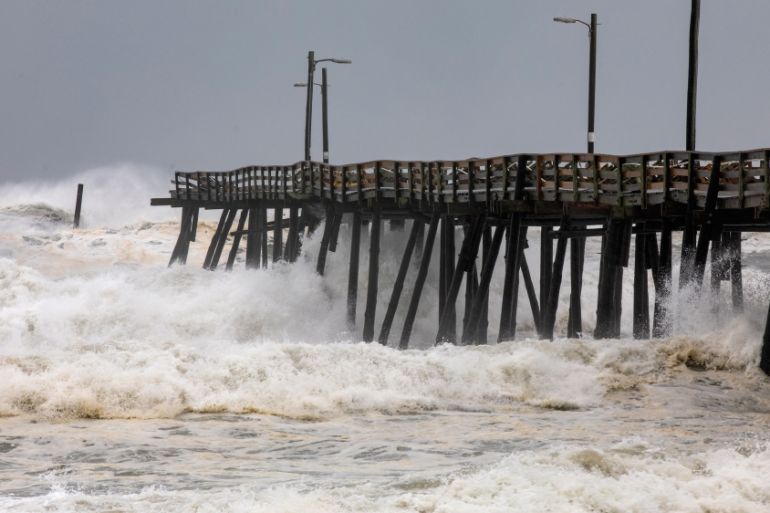
Hurricane Dorian is not yet done with North America. Although it remains out at sea, the bands of thunderstorms and onshore gales have plagued almost every Atlantic state.
Saturday morning saw Cape Cod and Nantucket Island getting battered by gale-force winds and heavy rain. Officially, Dorian is still a category 1 hurricane, despite being outside the tropics.
Keep reading
list of 4 itemsAfter the Hurricane
World’s coral reefs face global bleaching crisis
Why is Germany maintaining economic ties with China?
Its next landfall, the seventh, will be on Canadian province Nova Scotia. Hurricane warnings are in force for eastern Nova Scotia and western Newfoundland.
Gusts before the end of Saturday are forecast to be over 140km an hour in Halifax Bay, Nova Scotia, but the steady blow is more likely to be a severe gale into the harbour.
About 200mm of rain is predicted. A storm surge of up to a metre will funnel into the bays of Nova Scotia’s Atlantic coast.
Korean Peninsula
Meanwhile, Typhoon Lingling made landfall in the southwest corner of North Korea at about 06:00 GMT on Saturday.
Having been a super-typhoon, the equivalent of a category 4 hurricane while in the East China Sea, Lingling finally brought its eye onshore as a category 1 storm.
Haeju, a city to the east of the typhoon centre, reported winds of 100km/h. The forecast path of heavy rain from this declining cyclone goes over the top of Pyongyang.
Anything up to 150mm could be collected as downpours cross the city.
Japan
Close by, the still strengthening Typhoon Faxai, with winds already above 170km/h, is approaching Japan.
It is unlikely to affect Kyushu, which witnessed heavy floods this year, but may make landfall in capital Tokyo itself.
The forecast brings winds of typhoon strength to the coast of Honshu on Sunday night, equivalent to that of a category 2 on the Saffir-Simpson scale.
Tokyo is likely to be battered by severe gales, but the typhoon is currently expected to be at its worst over the Boso Peninsula.
Tokyo is protected from the Pacific by this peninsula but if the eye of Faxai drifts into Tokyo Bay, the city may face serious risk.
Storm surge risk is put at up to one metre above normal tide along the Boso Peninsula and adjacent parts of Honshu.
Rainfall of 200-400mm may cause flooding and, on higher grounds, landslides.
Source: Al Jazeera