UK braced for gale force winds and flooding
A powerful storm is heading to UK threatening widespread disruption.
Published On 8 Dec 2019
The first named storm of the season, labelled Atiyah by Met Eireann, the Irish Meteorological Service, is expected to make landfall and move across the country during Sunday and Monday.
The United Kingdom‘s Met Office, in collaboration with Met Eireann, began naming storms in October 2013 following a deadly storm in Europe that led to 17 deaths.
Keep reading
list of 4 itemsCoral reefs around the world experiencing mass bleaching, scientists say
Mass evacuations as floods in Russia’s Kurgan region set to peak
Floods kill 58 in Tanzania with heavy rains persisting
For the first time this year, the Royal Netherlands Meteorological Institute (KNMI) is also participating, collaborating with determining the severity of the storms and the naming process.
The criteria used for naming storms is based on the National Severe Weather Warnings service and is based on a combination of both the impact the weather may have, and the likelihood of those impacts occurring.
For Atiyah, the UK Met Office issued wind warnings for areas across the west until 09:00 GMT on Monday. These warnings may well be extended as the storm heads east.
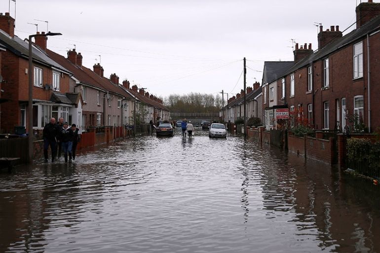
The Environment Agency, responsible for monitoring rising river levels, currently has more than 30 flood warnings and alerts in place throughout England and Scotland. Severe gales are also expected.
Western coastal areas will feel the worst impact with winds of up to 110 kilometres per hour (70 miles per hour), also producing large, damaging waves. As the storm moves inland, winds will reach speeds up to 95 km/h (60 mph), bringing widespread travel disruption.
Delays and cancellations are expected on the UK’s railways and roads. The strength of the winds is also expected to bring widespread power cuts throughout England and Wales from Sunday afternoon.
The Met Office has warned that along with possible power cuts, some damage is likely to be caused to buildings and almost certainly to temporary structures.
All of this comes just one month after torrential rains caused severe flooding across areas of Yorkshire and the Midlands.
The storm is expected to move to the east coast of northern England and Scotland in the early hours of Monday with heavy rain and wind gusting up to 90 km/h (55 mph)
Another round of extremely wet and windy weather is expected by Tuesday and to last into Wednesday.
Source: Al Jazeera, News Agencies