Tropical Cyclone Matmo is reborn as Bulbul
A rare overland passage by a tropical cyclone brings a threat to India and Bangladesh.

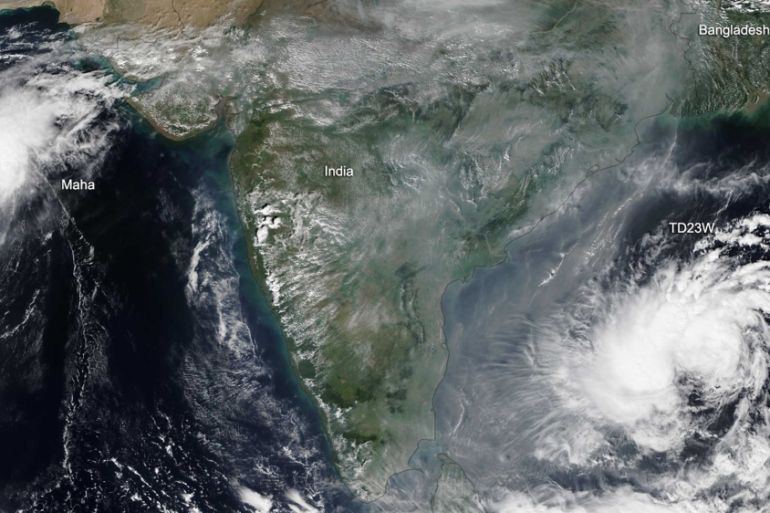
Tropical Storm Matmo has just revived itself after travelling about 1,800km (1,118 miles) overland. This is an unusual, but not unique, event.
Matmo was formed in the Philippine Sea, the birthplace of so many tropical cyclones, on October 24. It formally became a tropical storm in the South China Sea on October 30, after having enhanced the rain over the central Philippines, causing floods.
Keep reading
list of 4 itemsAfter the Hurricane
World’s coral reefs face global bleaching crisis
Why is Germany maintaining economic ties with China?
As a tropical storm, it continued west onto the coast of Vietnam, south of Qui Nhon, making landfall on October 31. At that point, winds were recorded at 112 kilometres per hour (70mph) and 200 millimetres (7.87 inches) of rain fell on the city.
Then came the westward journey overland that normally destroys any tropical cyclone. The fuel for any revolving tropical storm comes from water at a temperature above 27 degrees Celsius (80.6 degrees Fahrenheit). The Philippines Sea is at 30C (86F) and the South China Sea 29C (84F). It does not matter how warm the land is, it cannot evaporate enough moisture into the greedy storm to maintain its strength.
Matmo became almost a ghost, was not reported over Cambodia, brought increased cloud and humidity to Bangkok and Lop Buri, along with a little rain, then wandered into Myanmar.
The Andaman Sea is at 30C and, apparently magically, the remnants of Matmo, now over that sea, regained energy, spin, cloud and rain potential, and continued to drift westwards and were reclassified as a Tropical Storm at the start of Thursday.
With winds back up to 120kph (75mph), Matmo whipped waves up to seven metres (23 feet) high. Almost in the middle of the Bay of Bengal, the cyclone is mainly a risk to shipping for the next two days. It has a forecast course northwards, towards Kolkata and maybe then Chittagong.
Tropical Cyclone Matmo, renamed Bulbul by the India Meteorological Department, is likely to strengthen to become a Very Severe Tropical Storm (peak strength, equivalent to a Category 2 hurricane) on Saturday. The effects on the coast of Odisha are likely to be extremely rough high seas and lashing rain.
Interaction with, and landfall somewhere along, the mouths of the Ganges is likely on Sunday, near Kolkata. By then winds should be below gale force with a consequently smaller storm surge. Heavy rain is still likely.
Matmo is only the fourth tropical cyclone on record to re-develop over the Andaman Sea having crossed Southeast Asia overland. It is only the second to make it to hurricane strength, the last being in 1960.