More snow and strong winds for Germany, Austria
As blocked weather pattern matures, it will generate heavy snow and strong winds in parts of Europe.
Published On 9 Jan 2019
The meteorological services of both Austria and Germany issued warnings of more snow on Tuesday, which will remain in force until Friday morning.
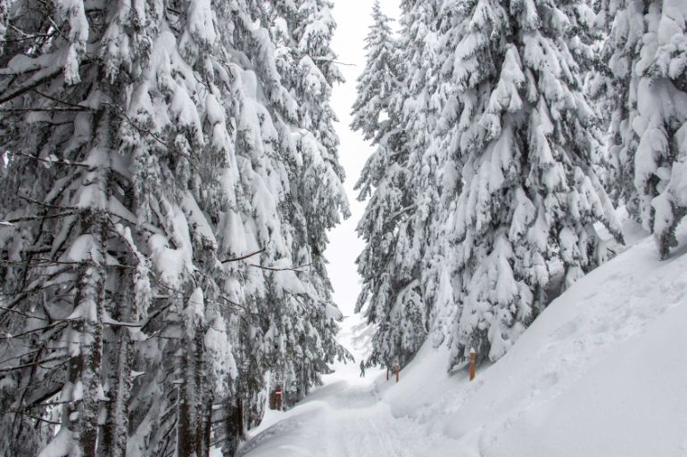
At the time of the announcement, two metres of snow had already fallen on the northern slopes of the European Alps since the start of the year.
Keep reading
list of 4 itemsAsia bears biggest climate-change brunt amid extreme weather: WMO
Photos: Highest-level rainstorm warning issued in south China’s Guangdong
Europe endured record number of ‘extreme heat stress’ days in 2023
With a stalled weather pattern, the second week of January has brought much more snow to a more focused area of Europe.
The Bavarian Alps in southern Germany and the Austrian Tyrol have seen at least another metre of snow fall in the space of two days.
In the resort town of Kitzbuhel in western Austria, half a metre of new snow fell on Tuesday night, leaving nearly two metres up on the ski slopes. This is over four times the snow depth throughout the 2016 season.
For skiers, this snow will turn out to be a blessing, but for travellers and residents throughout Austria, Germany, Poland, the Czech Republic and the Low Countries, road conditions have been poor and mountain passes have been closed.
Strengthening wind
As this weather pattern matures, an area of low pressure over the Baltic Sea has deepened, strengthening winds. Gusts of over 70 kilometres per hour blew the waters of the River Elbe into Hamburg, northern Germany.
Along the North Sea coast of Germany and the Netherlands, the onshore wind has been blowing a severe gale and gusting to over 100 km/h. In southern Germany, Munich airport had already cancelled flights because of the heavy snow a few days previously; winds on Tuesday blew at a steady 50 km/h and gusted regularly to nearly 70 km/h.
Strong winds, along with the heavy snow, are in the warnings for the Bavarian Alps and Austrian Tyrol.
Even stronger winds have been blowing down the Rhone Valley of southern France. Gusts over Cap Bear have been recorded at nearly 160 km/h on Wednesday morning.
This wind is called the Mistral and, as it blows through the western Mediterranean, it will likely generate waves up to 5 metres high. At risk are the western shores of Sardinia, the coasts of Menorca and the whole northern shore of Tunisia. The risk extends to Sicily and Malta during Thursday.
During Wednesday, yet another storm system developed in the Ionian Sea, to the west of Greece. This will generate heavy snow in the mountainous terrain of Montenegro, Albania, Greece and FYR Macedonia.
The wind, waves and snow are due to ease off by Friday.
Source: Al Jazeera