In Pictures
Satellite images show extent of damage in Tonga eruption
Satellite images show the spectacular eruption, with a plume of ash, steam and gas rising like a giant mushroom.
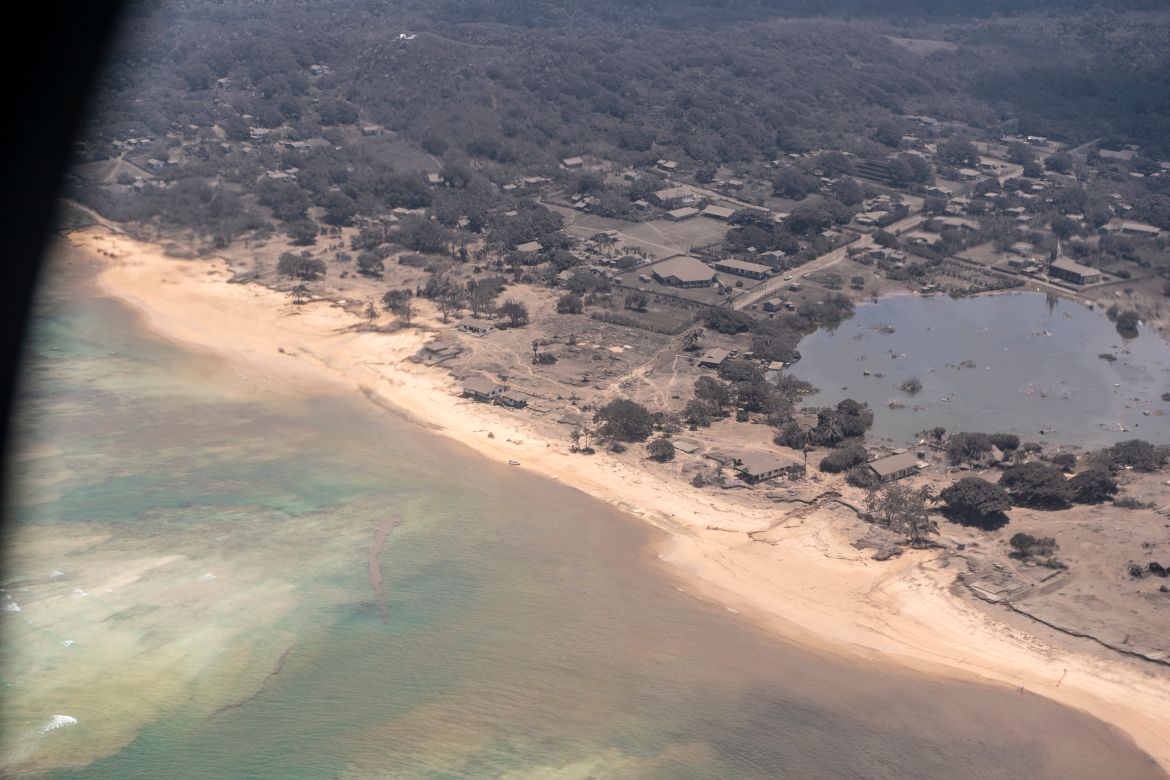
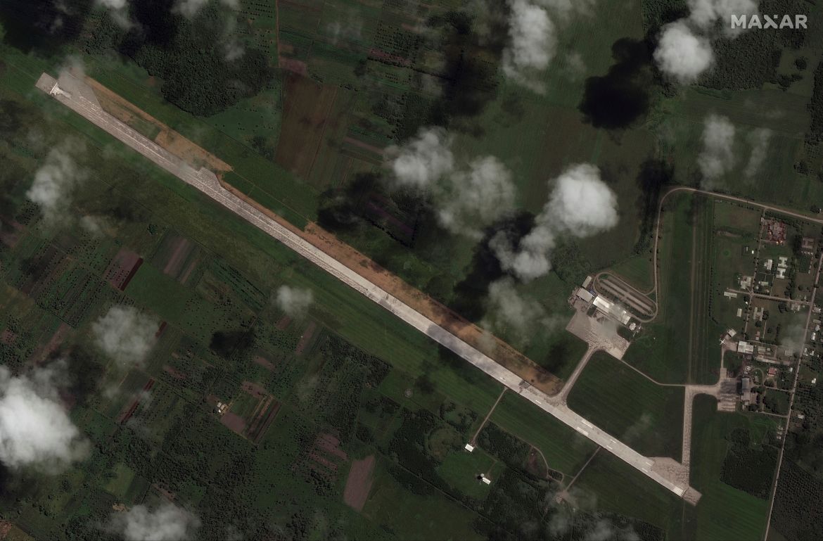
Thick ash on an airport runway has been delaying aid deliveries to the Pacific island nation of Tonga, where significant damage was being reported days after a huge undersea volcanic eruption and tsunami.
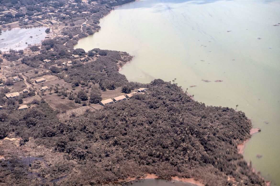
Tonga’s small outer islands were badly hit by a massive volcanic eruption and tsunami, a Tongan diplomat said on Tuesday, raising fears of more deaths and injuries.
“Alarming” images taken by New Zealand Defence Force (NZDF) reconnaissance flights showed an entire village destroyed on Mango Island and numerous buildings missing on nearby Atata Island, said Tonga’s deputy head of mission in Australia, Curtis Tu’ihalangingie.
“People panic, people run and get injuries,” Tu’ihalangingie told Reuters news agency. “Possibly, there will be more deaths. We just pray that is not the case.”
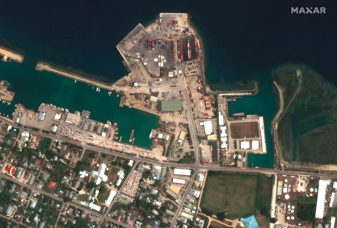
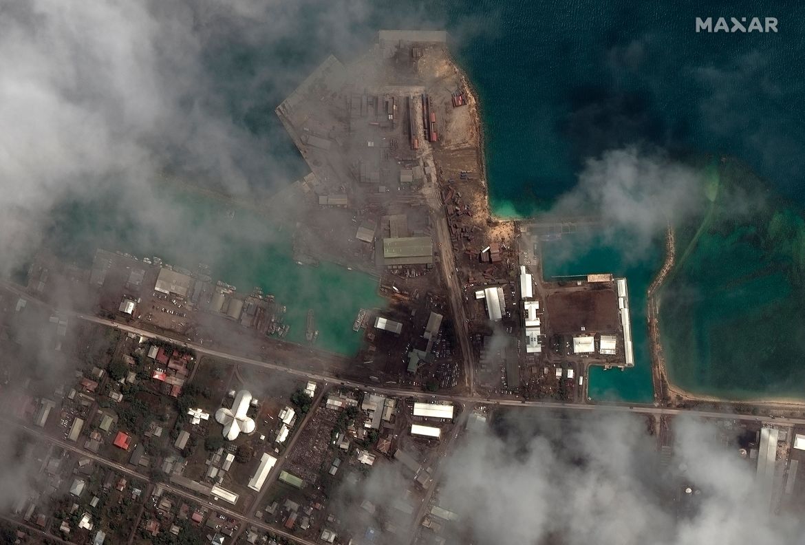
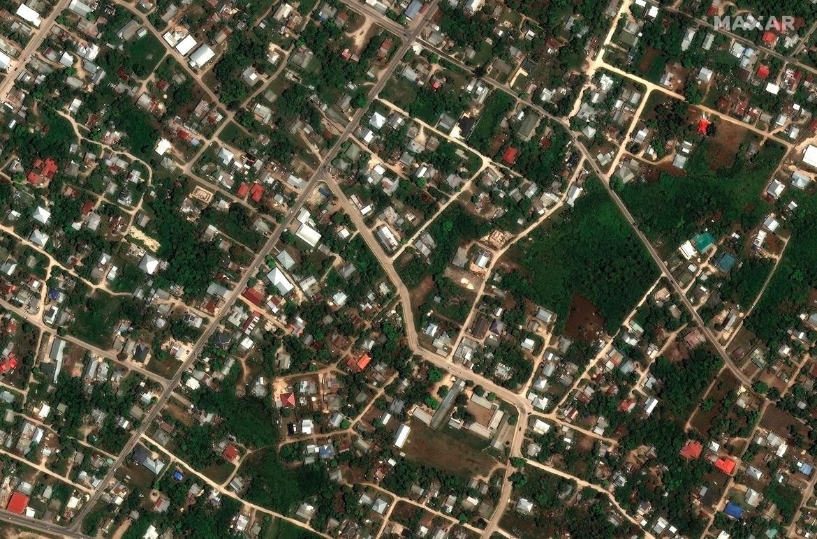
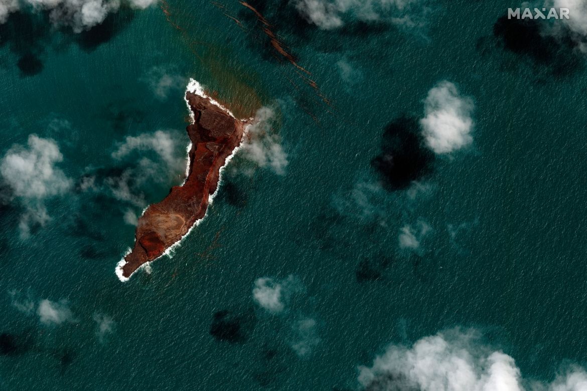
Maxar Technologies released aerial photographs of the Hunga Tonga-Hunga Ha’apai volcano and Tonga’s capital Nuku’alofa before and after its main eruption, which could be seen from space.
Satellite images captured the spectacular eruption, with a plume of ash, steam and gas rising like a giant mushroom above the South Pacific.
Tsunami waves of about 80cm (2.7 feet) crashed into Tonga’s shoreline and crossed the Pacific, causing minor damage from New Zealand to the US state of California.
The eruption set off a sonic boom that could be heard as far away as Alaska.
The explosion was the latest in a series of dramatic eruptions.
Tonga is a kingdom of 176 islands, of which 36 are inhabited, with a population of 104,494.
In late 2014 and early 2015, eruptions created a small new island and disrupted air travel to the Pacific archipelago.
