With North America’s largest river system at levels unseen for 70 years, authorities are sacrificing towns to save cities.
Officials expect three million acres (1.2 million hectares) to be flooded due to the activation of spillways and breaching of levees. This satellite image was taken on May 11, 2011, near Natchez, MI [NASA]
Published On 15 May 201115 May 2011
The controlled flood is expected to affect about 25,000 people and 11,000 structures. This satellite image was taken on April 21, 2011, before flooding began, near Natchez, MI [NASA]
The US Army Corps of Engineers detonated explosives to breach the Birds Point levee near Wyatt, MO, from May 2-5, flooding a 130,000 acre area. This satellite image was taken shortly after the breaches, and shows the resulting flooding of farmland [NASA]
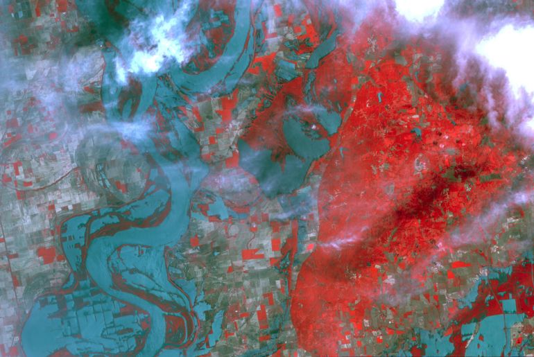
The trigger for the latest floodgate opening, at the Morganza spillway, occured on May 13, when the river reached a rate of 42,475 cubic metres per second at Red River Landing. This satellite image shows the effect of flooding in Memphis, TN, on May 10, when water levels hit 14.59 metres [NASA]
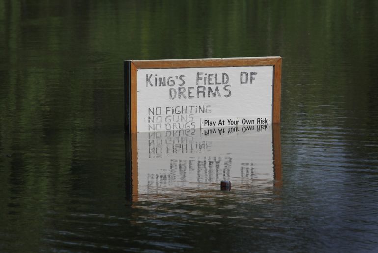
The flooding, caused by a combination of heavy rains and melting snow, has affected towns in the states of Mississippi, Missouri, Illinois, Kentucky, Tennessee, and Arkansas. [GALLO/GETTY]
The historic town of Vicksburg was expected to see a wave crest of 17.5 metres, topping a record of 17.1 metres set 84 years ago [GALLO/GETTY]
Authorities say they are adopting a policy of (***)Cities first(***), meaning that smaller communities will be flooded if need be in order to save larger urban centres, such as New Orleans. "What gives them the right to flood us? I understand it, but there are so many communities, and so many farmers and so many businesses," said Cindy Prejean, a resident of one such town in Louisiana [GALLO/GETTY]
The Morganza and Bonnet-Carre spillways have redirected water away from cities such as New Orleans. Water has been flowing along the former at a rate of 283.1 cubic metres per second towards the Atchafalaya Basin, from where it will hit Morgan City, and then the Gulf of Mexico [GALLO/GETTY]
The 32.2km long Morganza spillway was built in 1954, and can release water at a maximum rate of 17,000 cubic metres per second when all of its 125 gates are open [GALLO/GETTY]
This satellite image was taken on May 5, 1973, the last (and only previous) time the Morganza spillway was used. It shows the Atchafalaya Basin, into which water is expected to flow [NASA]