Darwin awakes to rolling thunder and flashing skies
Pre-monsoon thunderstorms give a continuous display of lightning in Australia’s Top End.
Published On 28 Nov 2015
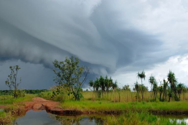
A severe thunderstorm tore through Darwin early on Saturday morning, bringing damaging winds and heavy rain. Within a 50km radius of Darwin’s city centre, over 12,000 lightning strikes were detected. Considering the short duration of the storm, that works out to be around two strikes a second.
Australia’s Top End, which includes Darwin, Katherine, Kakadu and Arnhem Land, has a tropical climate and has two distinct seasons, the ‘wet’ and the ‘dry’. The wet season stretches from November to April and is characterised by increased humidity followed by monsoonal rains and storms.
Keep reading
list of 4 itemsAfter the Hurricane
World’s coral reefs face global bleaching crisis
Why is Germany maintaining economic ties with China?
|
|
The pre-monsoon build-up is well and truly under way, with thundery afternoon showers becoming commonplace over the Top End. Although heavy rainfall is not unusual in these tropical storms, totals were still impressive. Dum In Mirrie Island collected 59mm from this storm – 45mm of which fell within half-an-hour.
As a comparison, the November average rainfall in Canberra, the country’s capital, is just 65mm.
A strong El Nino continues in the tropical Pacific Ocean, and is very likely to persist into early 2016.
However, El Nino’s influence on Australia’s rainfall is variable. On average, an El Nino summer brings lower than normal rainfall across northern Queensland with a later start to the wet season. During El Nino, ocean temperatures around Australia tend to be lower, leading to decreased rainfall.
Wandering thunderstorms always make a mockery of averages, and the tropical variety are often intense and the cause of flash floods. Even during an El Nino year, such storms will occur.
Source: Al Jazeera, News Agencies